Maps

Explore our collection of new and historic maps of the Stellwagen Bank National Marine Sanctuary region.

A map of stellwagen bank national marine sanctuary
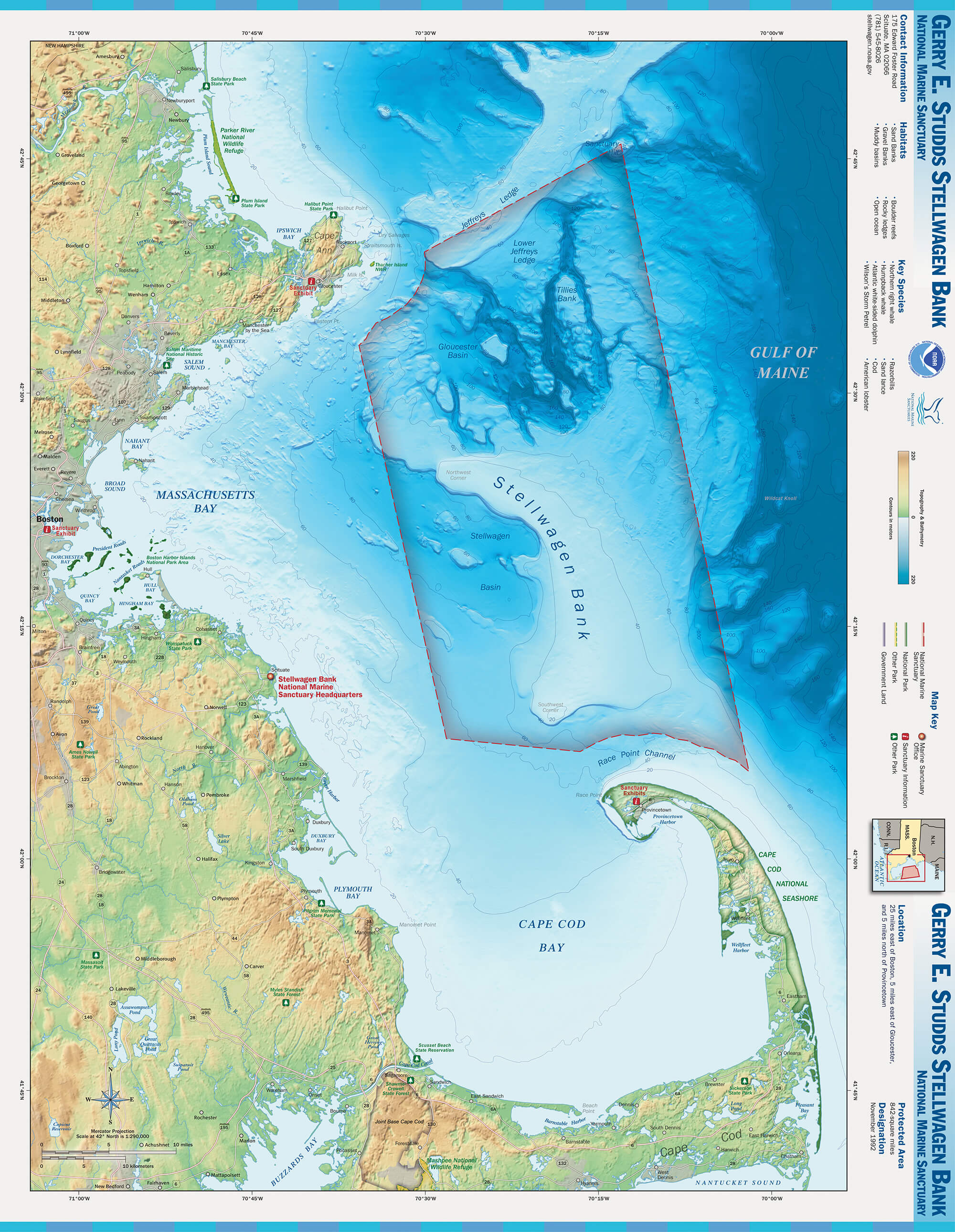
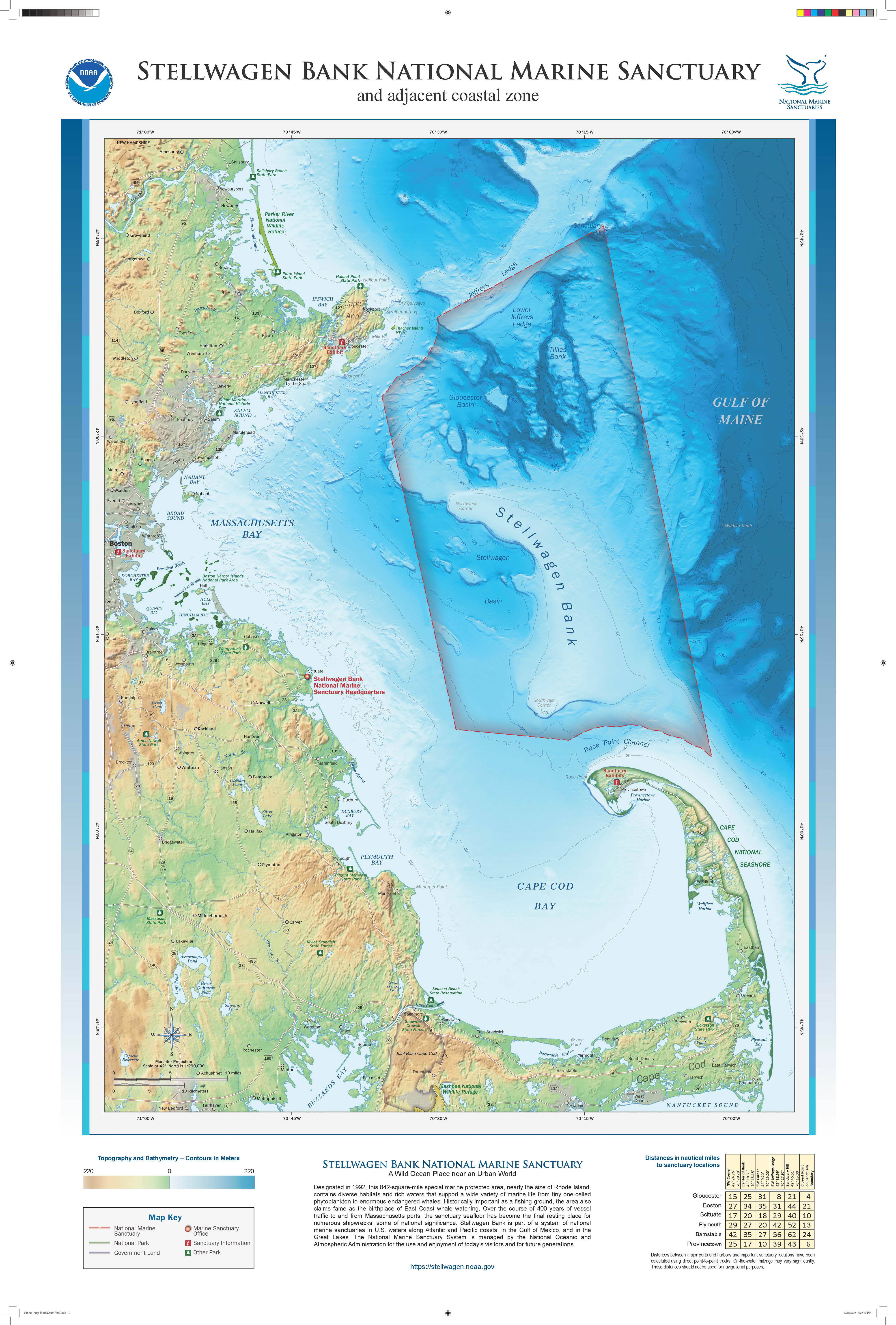
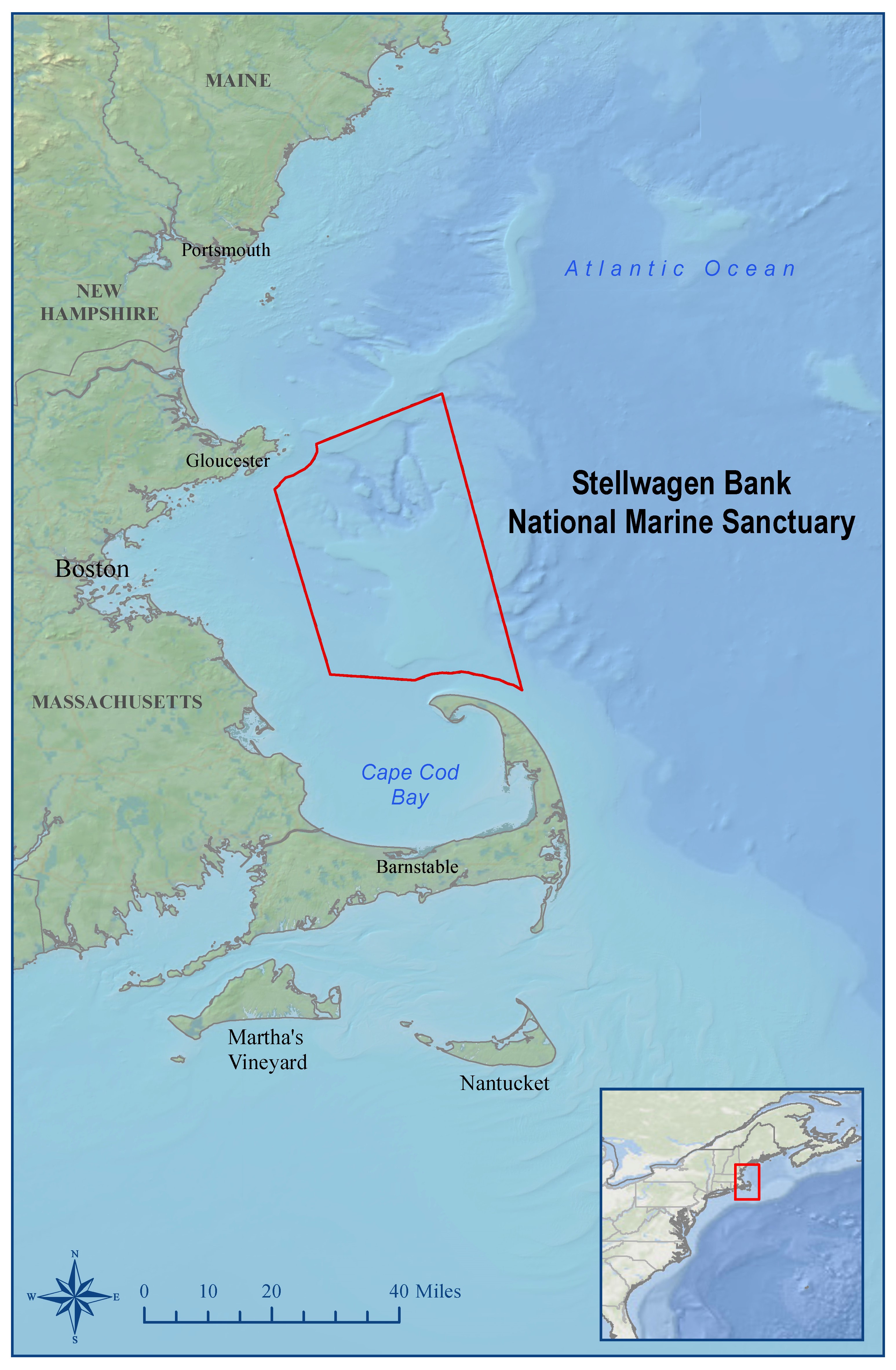
Atlas map for Stellwagen Bank National Marine Sanctuary showing coastal communities and seafloor bathymetry. The map is not to be used for navigation purposes; for that purpose, please consult NOAA Nautical Charts.

Download

A map of stellwagen bank national marine sanctuary
Full color 24"x36" poster is available for pickup at the sanctuary.

Download

A map showing the bathymetry of stellwagen bank national marine sanctuary
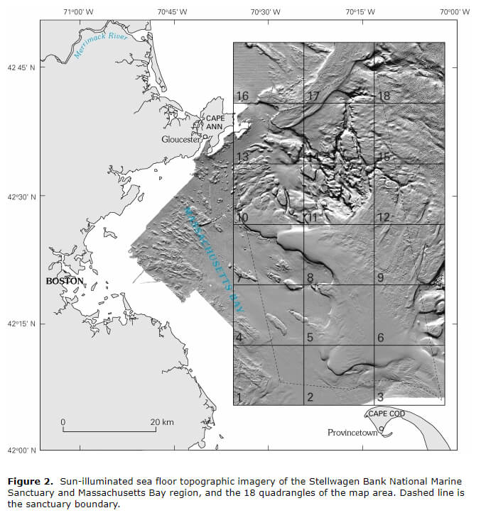
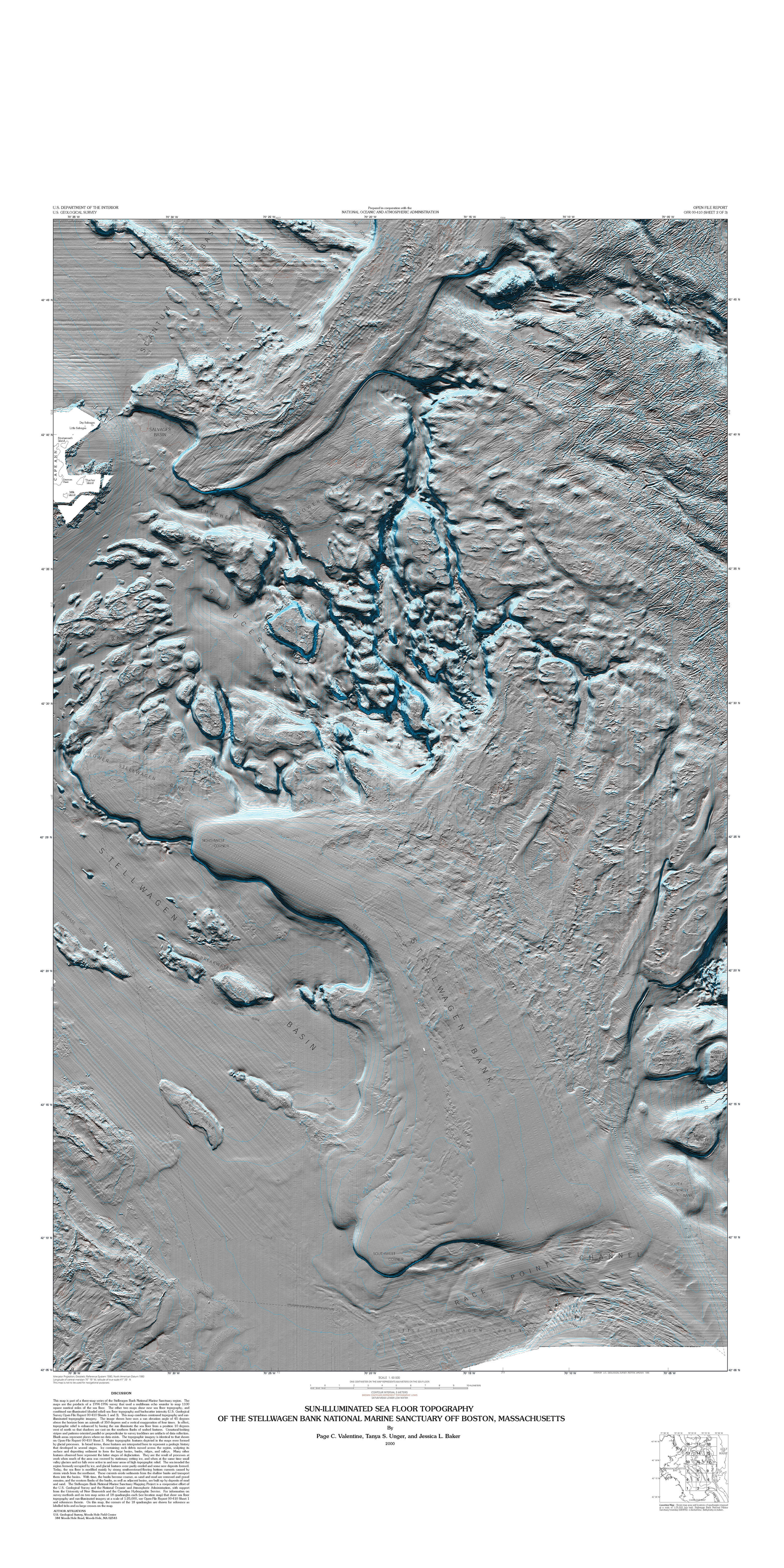
U.S. Geological Survey black and white map showing bathymetry of the sanctuary. Virtual sun illumination provides greater emphasis on seafloor features. The 18-square-grid demarcates areas for where detailed work on sediment characterization has occurred. For more information about this mapping project, visit the U.S. Geological Survey website.

Download

A map showing the bathymetry of stellwagen bank national marine sanctuary
Geological Survey poster showing sun-illuminated bathymetry of the Stellwagen Bank region from USGS Open File Report 00410

Download

A multicolored map showing the seafloor of stellwagen bank national marine sanctuary
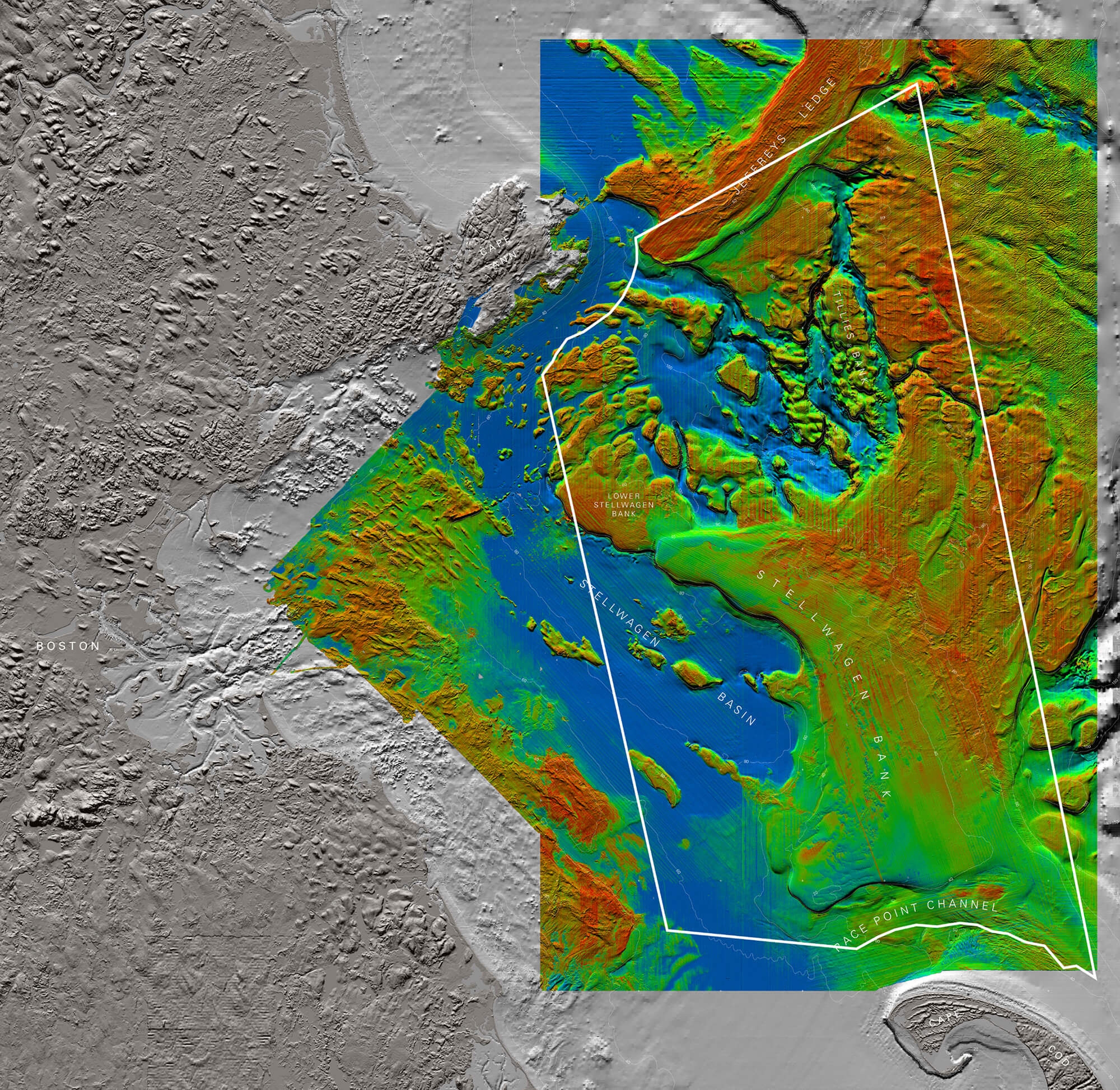
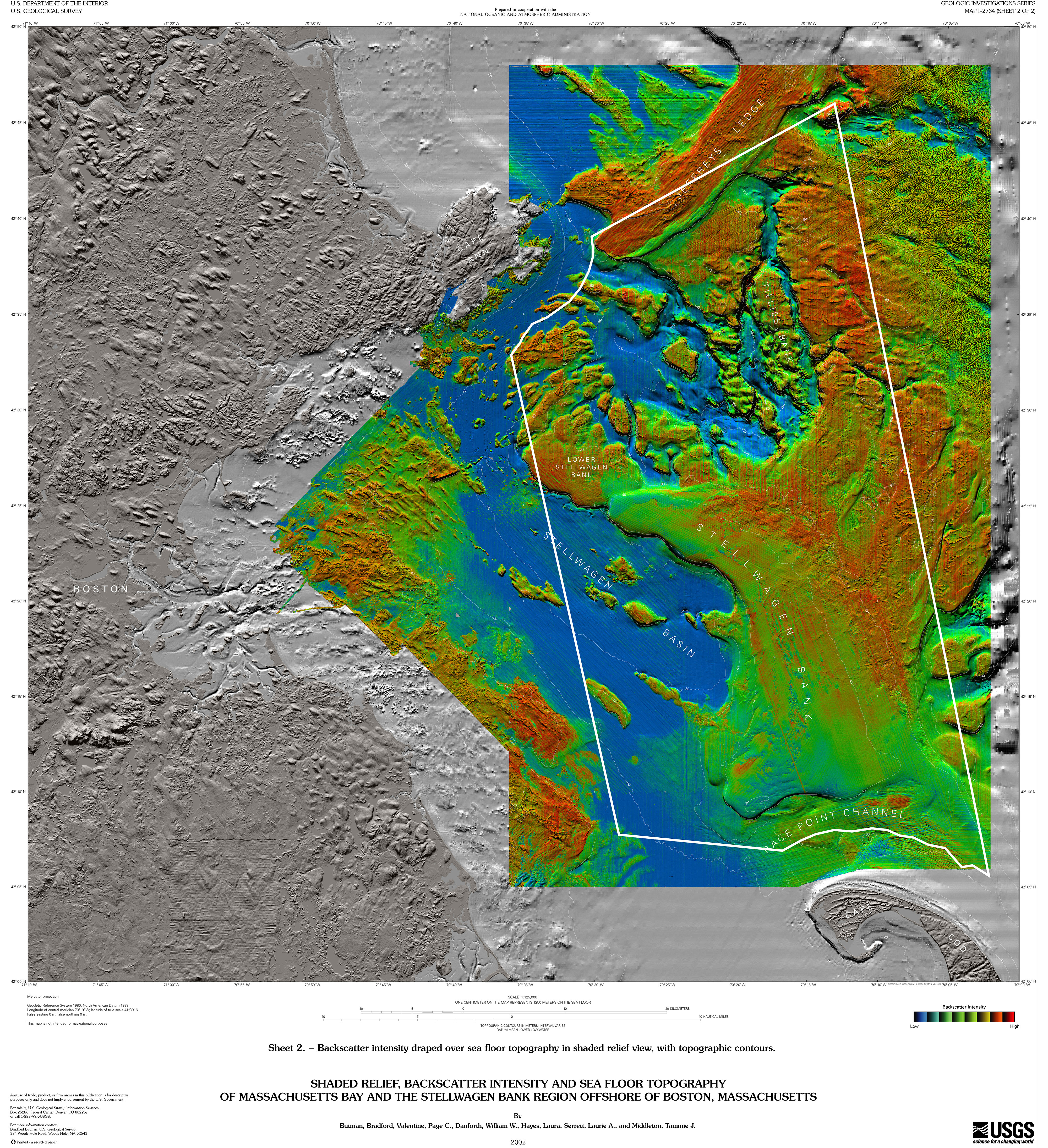
Geological Survey mapping project used backscatter of the multibeam sonar signal to define areas with softer to harder sediments, with blue indicating mud, green for sand, and red for higher intensity gravel substrates.

Download

A multicolored map showing the seafloor of stellwagen bank national marine sanctuary
Shaded Relief, Backscatter Intensity, and Sea Floor Topography of Massachusetts Bay and the Stellwagen Bank Region Offshore of Boston, Massachusetts. USGS Geologic Investigations Series, Map I-2734 (Sheet 2 of 2)

Download

An old map of the new england coast
John Smith (1635) map of the New England coast and local waters. A ship and pile of fish heads in the present area of the sanctuary indicates a rich fishing ground. Read more in our Maritime History section and the Stellwagen Bank Marine Historical Ecology Final Report.

Download

An old map of the new england coast
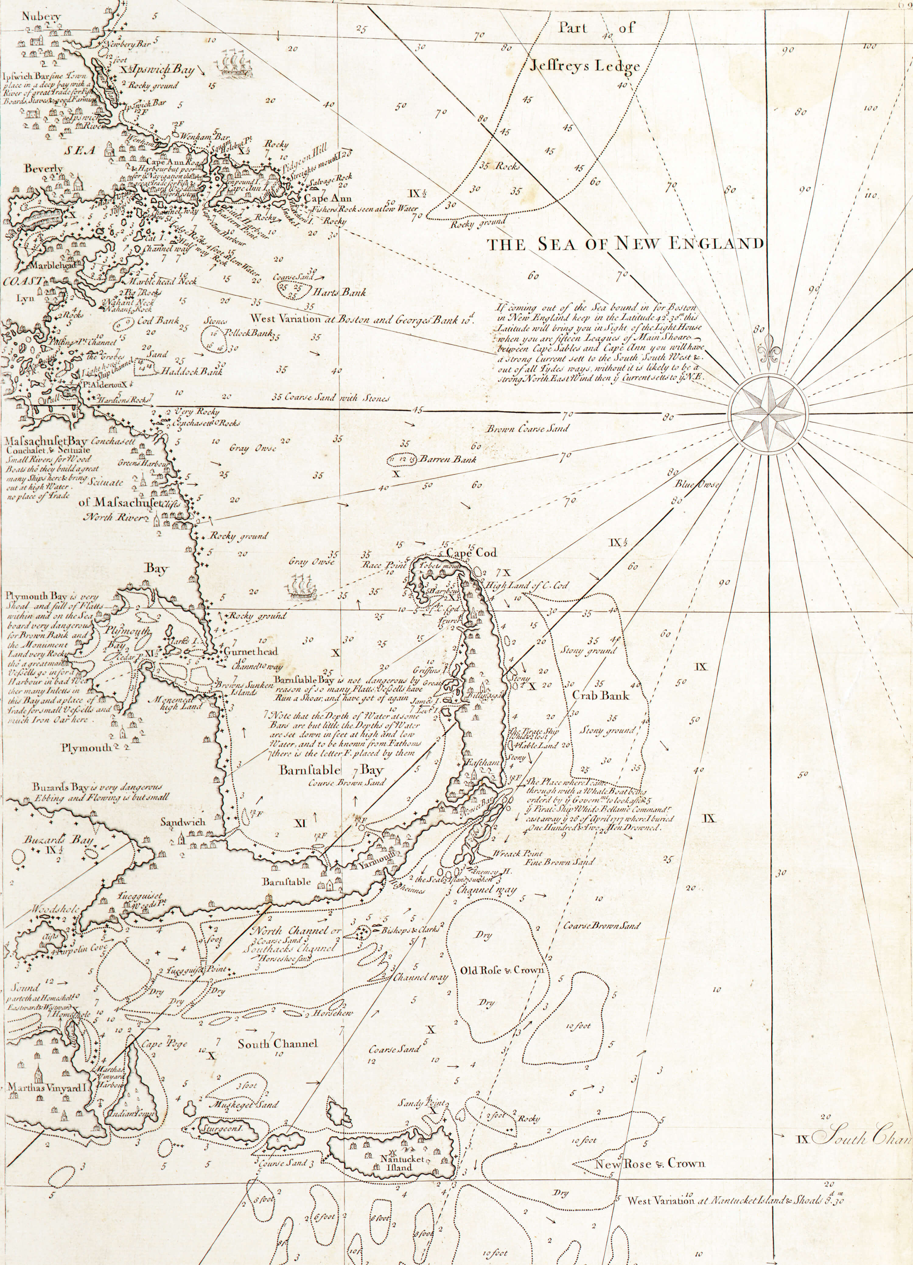
Cyprian Southack’s 1734 Coasting Pilot map of New England indicated a shallow area (Barren Bank) in the area of Stellwagen Bank’s southwest corner. Courtesy of Library of Congress, Geography and Map Division.

Download

An old map of stellwagen bank
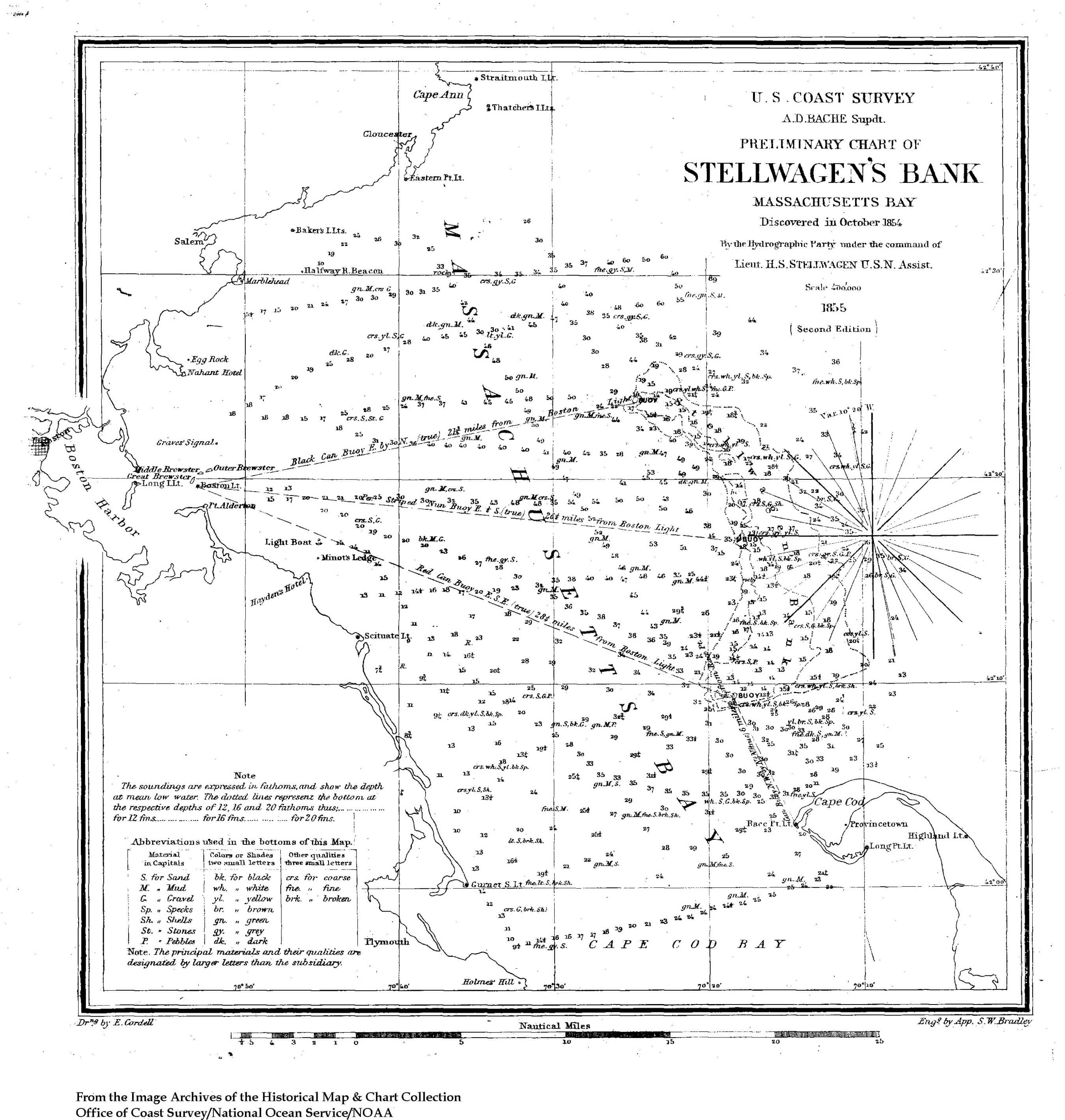
The U.S. Coast Survey issued this preliminary chart of Stellwagen’s Bank in 1855. The discovery of the bank was considered a significant achievement in aid of navigation. Read more at Discovery of Stellwagen Bank

Download

A 3D map showing the floor of stellwagen bank
Three-dimensional depiction of seafloor bathymetry for the Stellwagen Bank region by the U.S. Geological Survey using chart coordinates.

Download

A 3D map showing the floor of Gulf of Maine
Three-dimensional depiction of the Gulf of Maine, including Georges Bank, by the U.S. Geological Survey.

Download

A map of the gulf of maine
Gulf of Maine map with labels for seafloor features; adapted from a map by the U.S. Geological Survey.

Download

A map showing map showing bathymetry for Massachusetts Bay
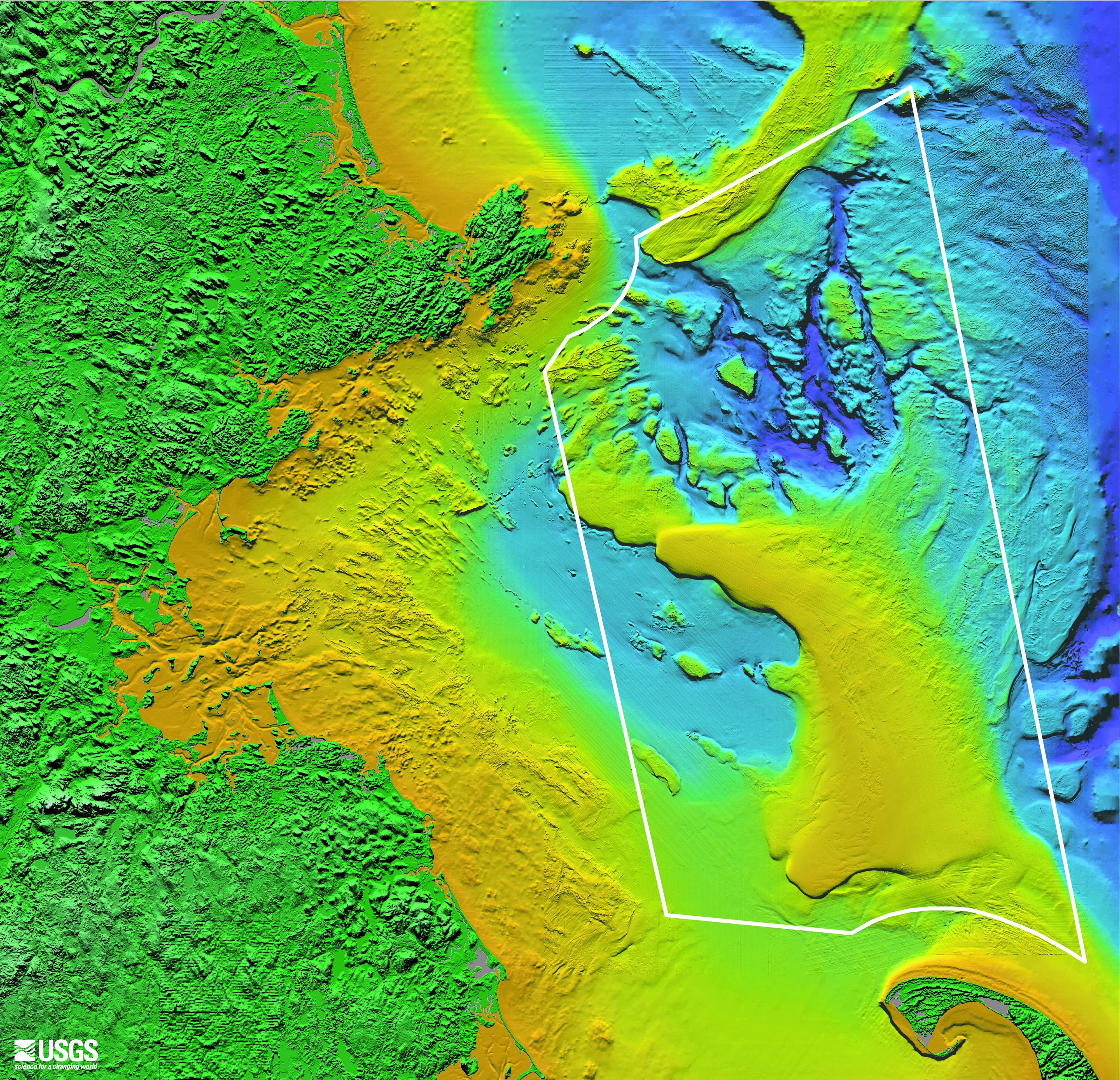
U.S. Geological Survey map showing bathymetry for Massachusetts Bay (green for land, yellow for shallow areas less than 50 meters depth, and blues for deeper waters) with the sanctuary boundary superimposed.

Download

a simple map of the boundries of stellwagen bank national marine sanctuary
A basic map of the sanctuary and sanctuary region. Map: NOAA

Download