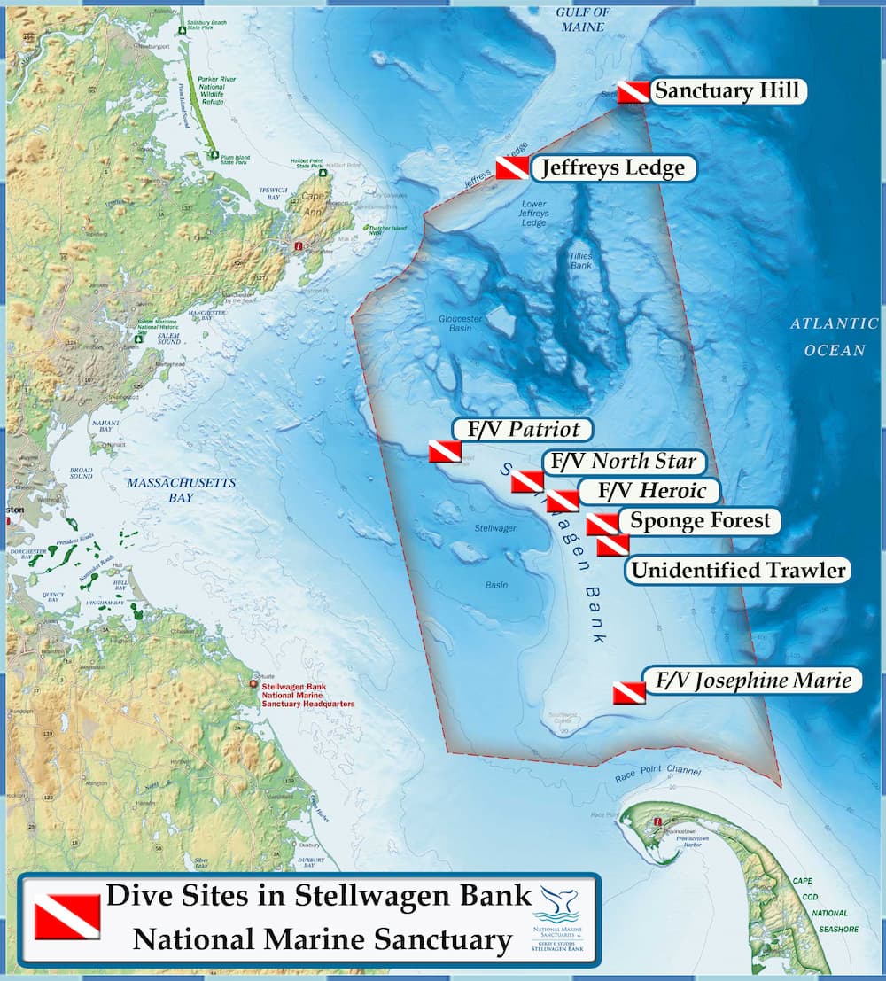
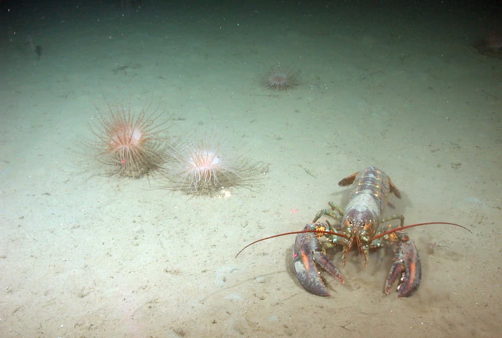
Stellwagen Bank's shallowest depths are at its southern end, which rises to within 65 feet of the surface. In this area, the sandy bottom is pockmarked with lobster holes. Moving north along the bank’s top, the seafloor slopes to a relatively constant depth of 100-110 feet. While diving the bank’s sandy areas offers the opportunity to view schooling fish such as sand lance, areas with hard-bottom habitat will host more sessile (anchored) and colorful life.
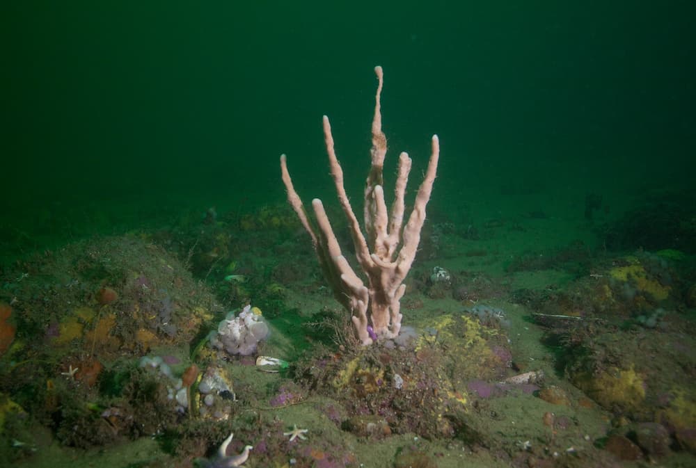
The Sponge Forest is centrally located on the bank and includes cobble and scattered boulders that provide hard substrate for encrusting marine invertebrates. The area was named for the large finger sponges found growing on the seafloor. Those sponges were not seen on a subsequent visit and may have been removed by fishing activity. Over time, it is expected that sponges may again take hold. The Sponge Forest lies within the Port of Boston’s Traffic Separation Scheme (TSS). Dive vessels must be on the lookout for large cargo vessels transiting the area and must not impede the passage of these vessels. Vessel operators should follow all regulations pertaining to the safe operation of vessels in a TSS.
Sponge Forest Coordinates
Degrees Minutes: 42 19.47096 N 70 17.598012 W
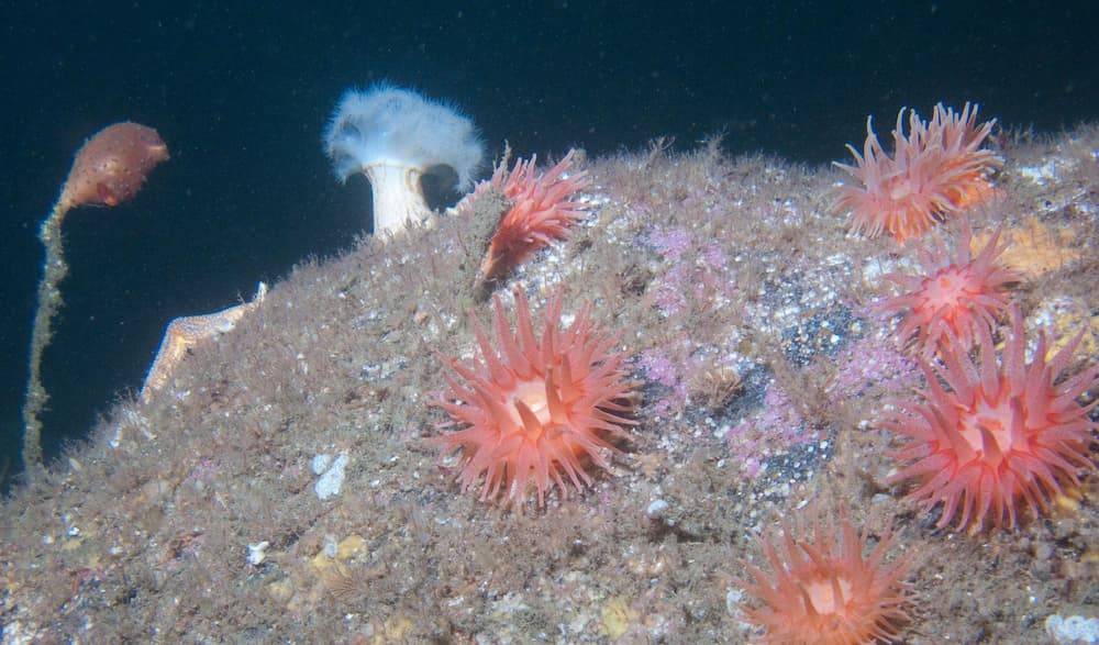
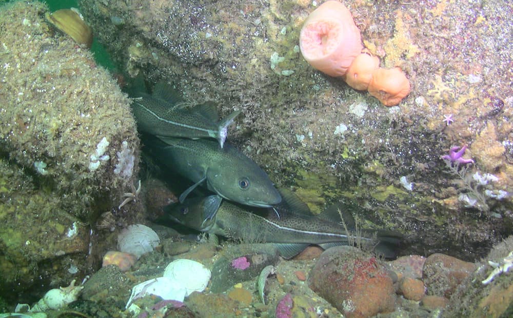
Before there was an Aquarius Reef Base (underwater habitat in the Florida Keys), there was Helgoland. This German saturation habitat made a stop on Jeffreys Ledge in 1975 to allow a NOAA research team to study marine life on Jeffreys Ledge. Remnants of the habitat’s infrastructure can be explored today along with a variety of marine life. The southern section of Jeffreys Ledge sits in the northern part of the sanctuary. Rocky ridges, piled cobble and boulders on the ledge rise to within 110 feet of the surface. Anemones, stalked tunicates, and coralline algae reside on the rocks, making for a colorful landscape when illuminated with a dive light. The ledge’s piled boulders create a complex structure with many crevices for marine fishes like cusk and wolffish.
Helgoland Coordinates
Degrees Minutes: 42 40.941 N 70 24.251 W
In the sanctuary's northeast corner, Sanctuary Hill rises from 325 feet to 115 feet and is topped with solid granite and piled boulders. Like Jeffreys Ledge, the hill’s hard substrate is home to a variety of invertebrates and fishes that live on and among the piled boulders. Since Sanctuary Hill is 18 nautical miles offshore, the bedrock outcropping experiences very strong currents. Reportedly, blue and porbeagle sharks visit areas with steeply sloping topography like Sanctuary Hill.
Sanctuary Hill Coordinates
Degrees Minutes: 42 45.505 N 70 13.122 W
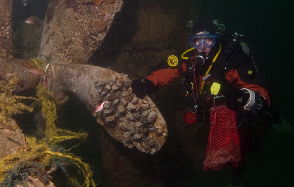
This 97-foot fishing vessel started out as a U.S. Navy coastal minesweeper, commissioned in 1942 and designated AMc-84). The USS Heroic spent much of WWII patrolling waters in Chesapeake Bay. After decommissioning in 1945, it had several owners and names until 1960 when it again became the Heroic and repurposed as an eastern rig fishing vessel out of Gloucester. On August 21, 1969, on a trip to Georges Bank, a fire in the engine room spread. The vessel sank approximately halfway between Provincetown and Gloucester. Luckily, the entire crew was rescued. A mooring buoy was placed nearby but has been lost due to suspected scallop fishing.
Heroic Coordinates
Degrees Minutes: 42 22.346 N 70 22.229 W
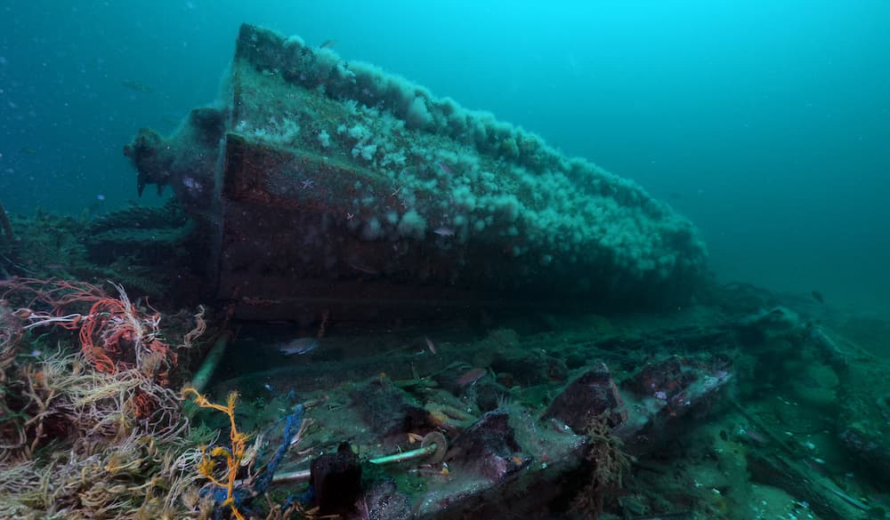
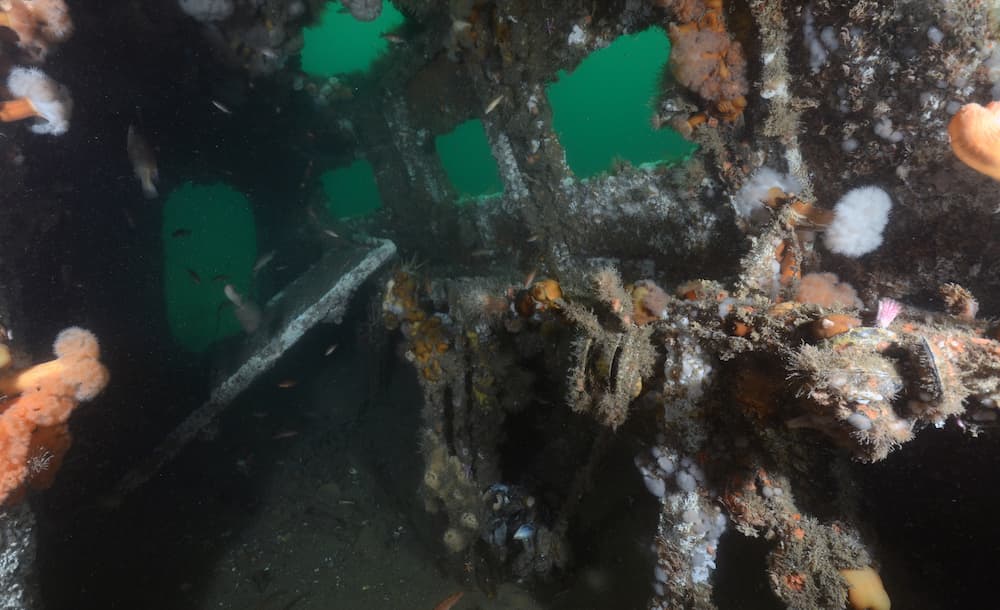
The fishing vessel Josephine Marie lies on the southern end of Stellwagen Bank in 105 feet of water. The 80-foot long, steel-hulled stern trawler was built in 1969 and actively fished in Massachusetts Bay until February 1, 1992 when disaster struck. The red and black-hulled Josephine Marie lies upside down with its bow facing roughly southeast. Divers should be aware of hazards such as strong currents and entangling fishing gear.
Josephine Marie Coordinates
Degrees Minutes: 42 10.925 N 70 13.466 W
The fishing vessel Patriot lies on its starboard side in 100 feet of water on the northwest corner of Stellwagen Bank. The 62-foot, steel-hulled dragger sank while fishing in 2009. Two fishermen perished when it sank. The wreck is now home to schools of pollock and other groundfish. Divers should be on the lookout for entangling fishing nets. Please do not disturb the shipwreck.
Patriot Coordinates
Degrees Minutes: 42 24.256 N 70 27.197 W
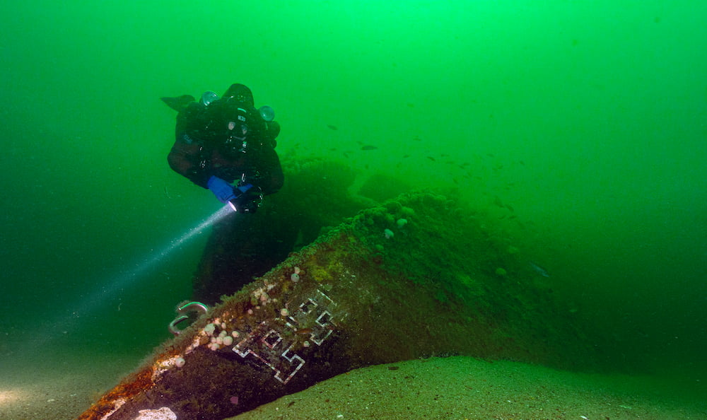
An unidentified trawler shipwreck rests on Stellwagen Bank in 105-110 feet of water. The trawler is broken into four pieces: pilothouse, hull, stern, and net reel. Smaller hull fragments surround the site. As the shipwreck sits on a mostly featureless sand bottom, it attracts schools of groundfish that hide within its structure. The identity of this trawler has not been determined, and the sanctuary is seeking help from anyone who might know its name. The trawler lies within the Outbound Lane of the Port of Boston’s Traffic Separation Scheme (TSS). Vessel operators should follow all regulations pertaining to the safe operation of vessels in a TSS. A mooring buoy has been installed at this site.
Unidentified Trawler Coordinates
Degrees Minutes: 42 18.7305 N 70 17.8425 W
Mooring Location
Degrees Minutes: 42 18.7278 N 70 17.8518 W