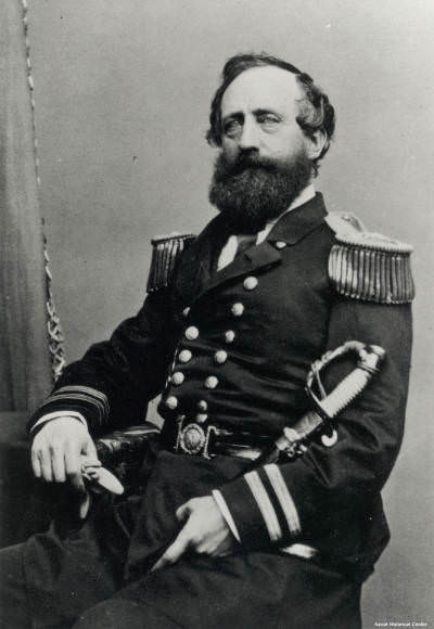
Discovery of Stellwagen Bank
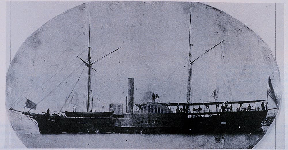
There was some knowledge of a shallower area at the mouth of Massachusetts Bay in the 1700s. Fishermen had called it Middle Ground for years. Some mariners' charts even noted it. But it took Henry Stellwagen, a Lieutenant in the U.S. Navy on loan to the U.S. Coast Survey (the forerunner to NOAA's Coast and Geodetic Survey) working from the U.S. Coast Survey steamer Bibb, to actually map the full length and breadth of the bank in 1854 and 1855.
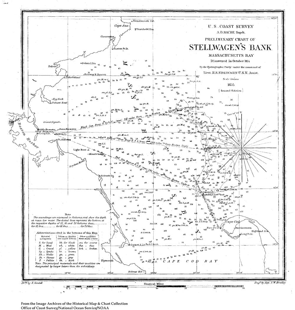
He wrote on October 22, 1854: "I consider I have made an important discovery in the location of a 15-fathom bank lying in a line between Cape Cod and Cape Ann – with 40 and 50 fathoms inside and to the northward of it and 35 fathoms just outside it. It is not on any chart I have been able to procure. We have traced nearly five miles in width and over six miles in length, it no doubt extending much further."
The importance of this discovery was not lost on Alexander Bache, the superintendent of the Coast Survey, who noted in the 1854 annual report that: "The hydrographer in Massachusetts Bay had been rewarded for his labors by the discovery in the entrance of an extensive bank, of which he had given the position and defined the limits, with from ten and a half to fourteen and a half fathoms on it, lying across the entrance, and serving thus as an excellent mark for navigators entering this important bay. I propose to call this, from the name of its discoverer, Stellwagen's Bank."
According to Stellwagen, "I consider promulgation of this discovery as very essential to navigators, and that the knowledge of it will highly benefit commanders of vessels bound in during thick weather, by day or night. By it they can not only ascertain their distance to the eastward of the coast, but by attention to the lead after passing inside, a good idea of latitude may also be obtained."
This military man with a talent for hydrography was also an inventor – he developed a sounding device with a steel cup covered by leather valves that could bring up specimens of the sea bottom. Used for many years by the Coast Survey, the invention won him the Scott Premium Medal from the Franklin Institute.
With his sounding device, Stellwagen not only measured the size of the bank but also the type of sediment on and around it. He stated, "The northern end of the bank has rocky bottom, with, however, a slight covering of fine black sand. The middle and southern parts are coarse white and yellow sand. The bottom inside of the bank, in deep water is generally a green unctuous mud, or ooze."
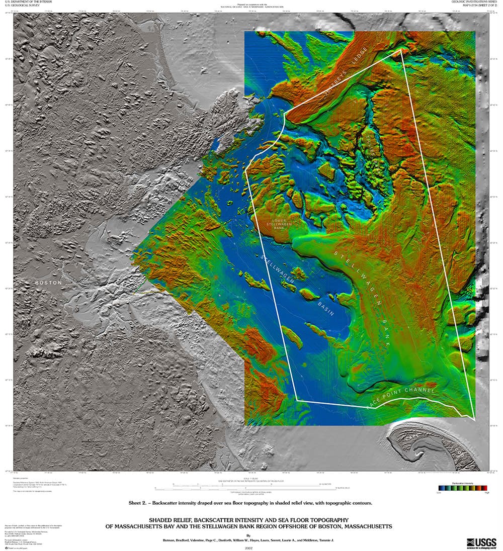
Today, we are fine tuning those observations with a detailed survey of the seafloor in the sanctuary. New multibeam and side-scan sonar survey systems allow scientists to get a precise reading of bathymetry (depth), while backscatter of the sound provides information on the hardness (hence type) of sediments.